
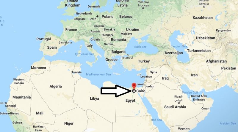
Where is Cairo? What Country is Cairo in? Cairo Map
Cairo is the capital of Egypt. Cairo is the country’s economic, trade, population, health, media, transportation and education center. It has a population of 16 million. Cairo is the largest city in Africa and the Arab world.
Where is Cairo?
Also Cairo is the 7th most populous in the world. It’s a residential area. Cairo is located on the east coast of the Nile River in the north of Egypt and on the river islands. It was home to many civilizations. There are many historical buildings in Cairo city.
Quick facts
| Country | Egypt |
| State | Muhafazat al Qahirah |
| Population | 7,734,614 |
| Elevation | 23 m over sea level |
| Time Zone | EEST |
| Longitude | 31.249670 |
| Latitude | 30.062630 |
| Airport | Cairo International Airport |
These are the places to visit in the city. It is one of the most important museums in the world. The Egyptian Museum, the symbol of Egypt and the Giza Pyramids in the Giza region, one of the largest markets in the Middle East, Khan al-Hali Bazaar, is one of Cairo’s most interesting places to worship during the fatimis period in 972, and the Cairo Citadel built in 1176 during Selahattin Eyyubi, and the Nile River, the longest river in the world.
Cairo has a climate of Mediterranean and desert climate. The best time to visit Cairo is between November and March. There are direct flights from America to Cairo.
Why is Cairo located where it is?
Is Egypt still a country?
Was Cairo part of ancient Egypt?
What is Cairo famous for?
What Cairo means?
Is Cairo a country?