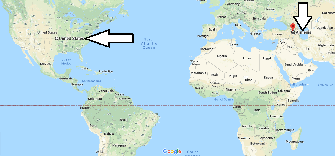
Where is Armenia? Located in The World? Armenia Map
Where is Armenia? / Where is Armenia Located in The World? / Armenia Map – Armenia is a country in the South Caucasus. Armenia is the neighbor of Nagorno-Karabakh Republic in the East and Azerbaijan, Turkey and Nakhichevan Autonomous Republic in the West, Iran in the South and Georgia in the north. Armenia’s country has no shore. However, the Lake Sevan is that largest lake in the Caucasus, is located within the borders of Armenia.
Where is Armenia?
Armenia is the Southern Caucasus country and consists of 11 regions, 49 cities and 866 rural areas. The capital of Armenia is also the largest city of Yerevan. The official language of Armenia is Armenian. In addition, Russian and English are very common in the country. Armenia, a secular state, has no official religion. But 90% of the country’s population is Armenian Apostolic Church; the remaining percentage is Catholic, Russian Orthodox, Muslim, Jewish and believed other faiths.
The country uses Armenian drama as its currency. The continental climate is dominant in Armenia, summers are hot and winters are cold. Therefore, the best time to visit the country is April and may. Armenia is among the countries demanding require a visa. There are direct flights from many cities of the world to Armenia. The country gained its independence in 1991, but was formerly a Soviet Union.
Quick facts
| Population | 2,970,495 |
| Density | 105.3 / km2 ( 272.8 / mi2 ) |
| Language | Armenian |
| Independence Year | 1991 |
| Capital | Yerevan (Yerevan) |
| Currency | Armenian Dram |
| GDP | 10,881,605,059 (2014 data) |
| GDP per Capita | 3,663 (2014 data) |
| Land Area | 28,203 km2 (10,889 mi2) |
| Water Area | 1,540 km2 (595 mi2) |
| Neighbouring Countries | Georgia, Iran, Azerbaijan, Turkey |
| Minimum Longitude | 43.460 |
| Maximum Longitude | 46.630 |
| Mininum Latitude | 38.840 |
| Maximum Latitude | 41.300 |
Goris : Goris is located in the Sunni region of Armenia. It’s a great city to visit. Armenia is the closest place to the Nagorno-Karabakh border. There are many natural beauty areas and historical structures. It is a city that must be seen in the world before it dies.
Gyumri : Gümrü is located 120 km northwest of the capital of Yerevan. It is the second largest city in the country with a population of about 160 thousand. This city also has a very important place in history. The Customs agreement signed between Armenia and Turkey on December 3, 1920 was concluded in this city.
Vanadzor : Vanadzor is located in the administrative district of Karakilise Lorri. The administrative center is the third largest city in the country with approximately 110,000 inhabitants. The name of the city comes from a Black Church here. There are many historical buildings and natural beauty areas to visit.
Blue Mosque : Blue Mosque is located in Yerevan, the capital of the country and the largest city. It is the Azeri-Turkish mosque built in 1764. Today, it is the only mosque open to worship. The architecture of the mosque is quite remarkable. It is preparing to be listed in the UNESCO World Heritage List recently. I say, if you get in the way, visit this mosque.
Map of Armenia
Picture of Armenia

Where is Armenia located in the world?
Is Armenia part of Europe?
What is the Armenian race?
What country is above Armenia?
Is Kim Kardashian Armenian?
Do they speak English in Armenia?

