
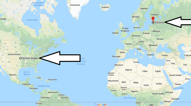
Where is Estonia? Located in The World? Estonia Map
Where is Estonia? / Where is Estonia Located in The World? / Estonia Map – Estonia is a Baltic state located in Northern Europe. Estonia is the first country to leave the Soviet Union and produce its own money. It is bordered by Russia to the East, Latvia to the south, the Gulf of Finland to the North, and the Baltic Sea to the East.
Where is Estonia?
There are more than 1,500 islands across the country. Hiiumaa and Saaremaa are the largest islands in the country and are located in the Baltic Sea. Estonia is Europe’s least-populated country. Estonia has 15 separate administrative units and consists of 183 rural municipalities, 30 cities and 15 districts.
The capital of the country is Tallin city. Estonian is the official language of Estonia. In addition, Russian, English, Finnish, German and Swedish languages are widely used in the country. Estonia has a temperate climate and winter in the country is rainy and cold and summer is hot. The best time to visit the country is spring and summer months. There are direct flights from many countries to Tallinn is which Tallinn city is the capital of the country.
Quick facts
| Population | 1,274,709 |
| Density | 30.1 / km2 ( 77.9 / mi2 ) |
| Language | Estonian |
| Independence Year | 1918 |
| Capital | Tallinn (Harju) |
| Currency | Euro |
| GDP | 25,904,874,312 (2014 data) |
| GDP per Capita | 20,322 (2014 data) |
| Land Area | 42,388 km2 (16,366 mi2) |
| Water Area | 2,840 km2 (1,097 mi2) |
| Neighbouring Countries | Russia, Latvia |
| Minimum Longitude | 21.810 |
| Maximum Longitude | 28.210 |
| Mininum Latitude | 57.510 |
| Maximum Latitude | 59.680 |
Tartu : Tartu, located in the southeast of the country, is the second largest city in the country with a population of more than 100,000. History dates back to the 1030s. There are many historical buildings to visit. There are also structures with great views. If you come to this city one day, you should definitely visit tourist buildings such as Tarbatu Castle, St. John Church, Tome Hill, Tartou Cathedral, old Observatory, City Palace Square, view of the Emajjo River, angel and Devil bridges. You can also taste city-specific delicious meals and buy souvenirs for your loved ones.
Parnu : Parnu is located on the coast of Pärnu Bay to the southwest of the country and is a holiday city to be visited. Founded in 1250, there are also many historical buildings in this city. What makes the city truly popular is the sea and health tourism. There are many sandy beaches, parks-gardens, hot springs and spa centers. You can come here with your loved ones and enjoy a wonderful holiday. The city has a large sandy beach, a large number of restaurants, cocktail bars, spas and many tourists throughout the year. Tourism in the country is one of the first places to come to mind when it is called. If you are travelling here, don’t go back and visit the attractions such as Sooma National Park, Lotte Village Theme Park, St. Elizabeth church, Red Tower, Modern Art Museum, mini zoo, Pärnu Beach, Valgeranna Adventure Park.
Narva : Narva is the third largest city in the country with a population of 60,000. The majority of the population consists of Russians. Located on the Russian border, this city is named after the river in the middle of the city. If you come to this city one day, you must visit tourist attractions such as Narva Museum, Narva Town Hall, kreenholm, Narva Alexander Cathedral and the dark Garden(Pimeed). It is one of the most visited cities in the country.
Map of Estonia
Picture of Estonia
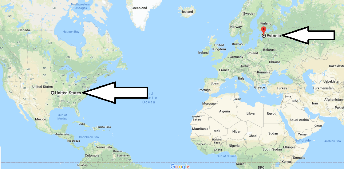
Where is the Estonia located?
Is Estonia a real country?
Is Estonia poor or rich country?
What kind of country is Estonia?
Is Estonia religious?
Do Estonians speak English?