
Where is Channel Islands National Park? What city is Channel Islands? How do I get to Channel Islands
Where is Channel Islands National Park?
State Of California
Type National Park
Location archipelago off the coast of Santa Barbara
Brief information of The national Park consists of five of the eight California channel Islands. More than 2000 land plants and animals can be found in the Park. Of these, more than 145 are endemic to the islands, i.e. they can only be found here. Marine plants and animals range from microscopic Plankton to endangered Blue Whale, the largest living animal. The Park includes the islands of San Miguel, Santa Rosa, Santa Cruz, Anacapa and Santa Barbara. Although these islands are incredibly close to the densely populated California coast, they have left their Isolation relatively undeveloped, making them a lovely place to discover for visitors.
Visitors the visitor centre in Ventura (mainland) has approximately 300,000 visitors per year (an average of 800 daily). Of these, about 10% are given to the islands.
What city is Channel Islands?
Size about 1,000 sq km (of which about half under water)
Open all year round
Arrival boat traffic to the islands is carried out by the Island Packers shipping company.
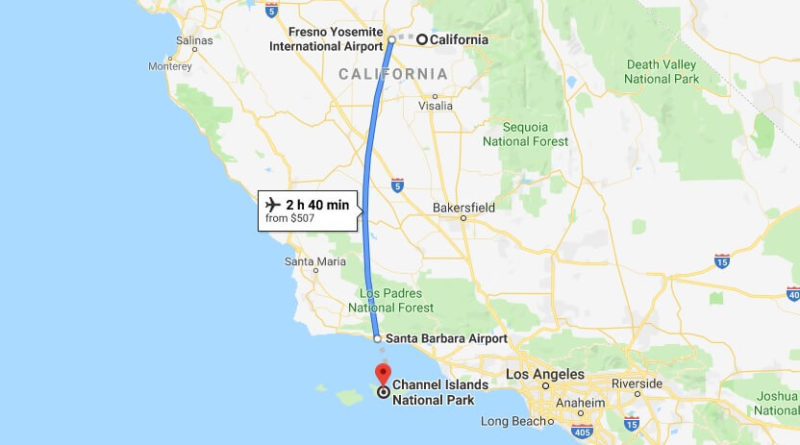
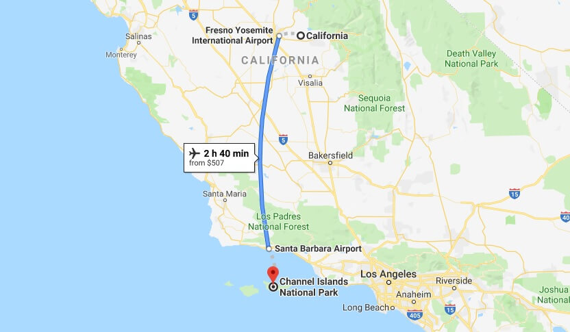
Flight options with Channel Islands Aviation.
Anacapa is closest to the mainland (1 hour boat ride), San Miguel is the most distant.
Admission free; transport costs to the islands
Facilities visitor centre in Ventura
Camping facilities on the islands (free permission in the visitor centre)
Otherwise, no infrastructure
Interesting visitor centre (mainland): the visitor centre in Ventura offers media as well as a botanical garden with native plants.
Anacapa Island: on Anacapa (2.8 sq km) there are hiking trails, a visitor centre and a lighthouse exhibition as well as a simple Camping place; it offers the opportunity to dive, snorkel, bird watching, and observe marine life.
Santa Barbara island: On Santa Barbara (2,6 sq. km) there are Hiking trails, a visitor centre and a basic campsite; it offers opportunities for Hiking, bird watching, diving, snorkeling, and for the observation of marine animals.
San Miguel island San Miguel (37,7 sq km), there is a simple campsite, many miles of Hiking trails and beaches; guided tours are offered, as well as opportunities for observation of marine mammals to beach studies, and bird watching.
Santa Rosa island: Santa Rosa (213,6 sq km) there are Hiking trails and a basic campsite. There are opportunities to discover the beaches, to observe wildlife, to guided hikes, as well as Jeep excursions.
Santa Cruz Island: the largest island (245.4 sq km) offers the opportunity to observe wild animals and to stay in private quarters.
Mainland coast: The sea is up to a distance of 1.6 km from the coastal part of the national Park. Here you can go sailing, motor boating, diving and snorkelling, as well as wildlife and birds watching.
Note multi-day stays on Santa Rosa and Santa Cruz, but especially on San Miguel must be very well planned and prepared. Do not expect any help on San Miguel, nor any medical.
Area Santa Monica Mountains NRA, Santa Barbara Museum of Natural History
How do I get to Channel Islands
How do you get to Channel Islands National Park?
What is Channel Islands National Park known for?
Is Catalina Island part of Channel Islands National Park?
How big is the Channel Islands National Park?
How much does it cost to get to the Channel Islands?
Is there cell service on Channel Islands?
Do you need a passport to go to Channel Islands?
What are the 8 Channel Islands?
Can I visit the Channel Islands?